This proposed listing forms part of the draft Cardiff Local Heritage List - Public Houses, Hotels and Clubs (current and former)
Building reference
34 The Pantmawr InnDate
Possible C18th origins – in use as a pub since c1960Ward
RhiwbinaHistory
Though there is reference to ‘Pantmawr Bach, in Whitchurch’ within the survey of Thomas Edwards’ Llandaff House Estate in 1776,1 the 1811 Budgen map shows a farmstead called ‘Pantwyn Mawr’ in the same location as today.
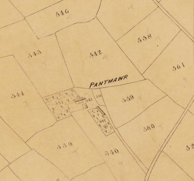
The property is much clearer within the tithe returns of 1840, identified as ‘Pantmawr’ and recorded as a 72-acre farm, owned by Sir Charles Morgan 2nd Baronet2 (occupied by Alexander Jones). The house is shown to the north-east of the farmstead enclosure on the same location/orientation as today, with an outbuilding to the south-east, fronting onto the driveway.
By 1875 the plan form of the house has altered slightly, and the outbuilding has been relocated, to the small enclosure to the right-hand side of the driveway.
This general arrangement persists into the middle of the twentieth century (see OS map of 1961), though further outbuildings proliferate to the north-east between 1898 and 1915.
These outbuildings were lost after 1961 (presumably when the premises were converted into a public house) and today their footprint may still be read within scars on the large parking area which still defines much of the former farmstead curtilage.
According to Brew Wales: “The Pantmawr is set in its own extensive grounds and parts of this stone-built building date back to 1828, although it was rebuilt in 1898 and refurbished only recently. The old buildings, built out of rough-hewn stone, were originally a farmhouse and associated farm buildings, it became a pub in 1960 when the local estate was built.”
No definitive evidence to support these claims has yet been found, save for the date for reconstruction, which is derived from a datestone located within the eastern gable.
¹ See Glamorgan Archive ref: DXGC123.
2 Of Tredegar House.
Description
The Pantmawr Inn is located within a suburban island, where the layout of surrounding housing was clearly defined by its presence within the landscape. The public house (former farmhouse) sits within a large curtilage – now a tarmac carpark (which still defines much of the former farmstead curtilage). The driveway from Tyla Teg Road still defines the remainder of its historic access route from Pantmawr Road.
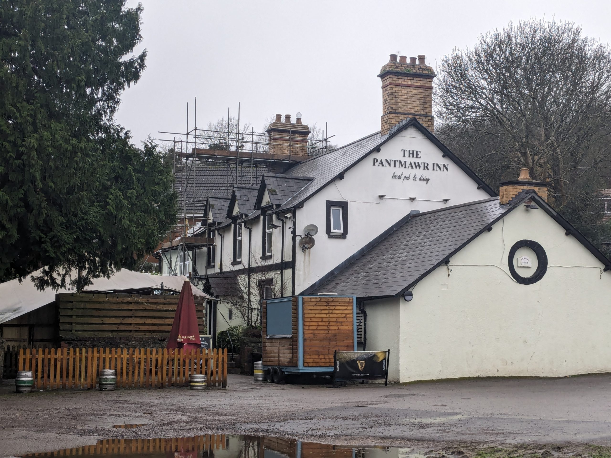
The principal portion of the Inn is a two-storey three-bay range, orientated to face south-south-west, with a perpendicular range to the rear (set lower but also of two storeys). The front elevation has a central entrance doorway, with modern uPVC windows throughout. To the first floor, windows are gabled and break through the eaves line.
There is a further two-storey extension to the west (set slightly lower) and a single storey outbuilding extension to the east, both upon the same axis. Date stone within the eastern gable reads ‘Rebuilt 1898’. Roofs are pitched and gabled, with slate covering. Chimney stacks to either end of the principal range are formed in buff brick with ornate red brick set diagonally, as corbelling to take the crown.
There are small, modern single-storey flat-roof extensions to the rear.
Reason
The site has a long history, with origins as a C18 (if not earlier) farmstead. The amount of fabric surviving from the rebuild of 1898 is unclear, but parts of the building are said to date from 1828. Strong Evidential and Historical Value.
In use as a public house since c.1960, the building also has a limited Communal Value.
References
None found
Additional images

1840 Tithe Map

